Peripleo Receives Funding from the Research Software Maintenance Fund
Pelagios’s Peripleo is set for a re-boot.
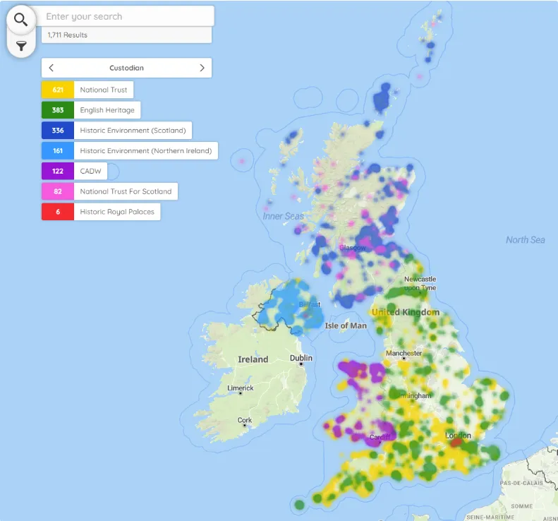
Peripleo is an open-source web mapping tool, developed in the final phase of the Pelagios project (2017-2019) as a demonstrator of georeferenced interlinked ancient world datasets. Since modified to be a browser-based tool that anybody can use, it been used to showcase the spatial footprint of collections held by the British Museum, the Archaeological Data Service, and Historic England. This summer it won funding from the Software Sustainability Institute to address a gap in the market, between a bespoke map that requires specialist coding skills and hosting services, and popular alternatives (e.g. Felt, Kepler, Carto, ArcGIS StoryMaps and Google MyMaps), which are easier to use but are not designed for research, impose rigid data structures, and depend on commercial providers.
Work on the new Peripleo starts in January 2027, with the aim of producing a single, sustainable mapping tool that any researcher or heritage organisation can deploy and configure without coding skills or hosting costs. The work has four interrelated strands:
1. Community is embedded in the project’s design by conducting user-testing with researchers across career stages and institution types, partnering with major research infrastructures, and establishing a formal governance structure through Pelagios.
2. Data preparation is currently the biggest barrier to adoption. Peripleo will extend a companion tool called Locolligo with an AI-assisted pipeline that allows researchers without coding skills to turn spreadsheets, PDFs and plain text into shareable, machine-readable data ready for mapping.
3. The architecture will be rebuilt as a single modern codebase using the open-source OpenLayers library. The tool will run entirely in users’ browsers, meaning instances can be hosted free on services such as GitHub Pages with no server or database to maintain.
4. The interface will support research-specific features, namely: representing uncertainty, filtering by historical period, and providing alternative projections. The software will meet WCAG 2.2 AA accessibility standards, opening research-grade mapping to users with diverse access needs for the first time. Maps will be publishable with DOIs as citable research outputs.